
Kia mārama ki ngā rārangi Puka Whenua
Understanding the Deeds Indexes
The Deeds Indexes held at each of our four archives have been a great source of information for researchers since they were transferred to our care in 2010.
Something we’ve found important is to understand what the Deeds Indexes represent. An understanding of the scope of the indexes can go a long way to answering questions and it can help researchers identify where they should look for information.
The Deeds Index is the core index to the Deeds system of private (freehold) land ownership. Each archive holds Deeds Indexes from the Land Districts in their respective areas. The Deeds System includes a variety of indexes and registers but it is rare for anyone’s research of Deeds System records to conclude successfully without using a Deeds Index.
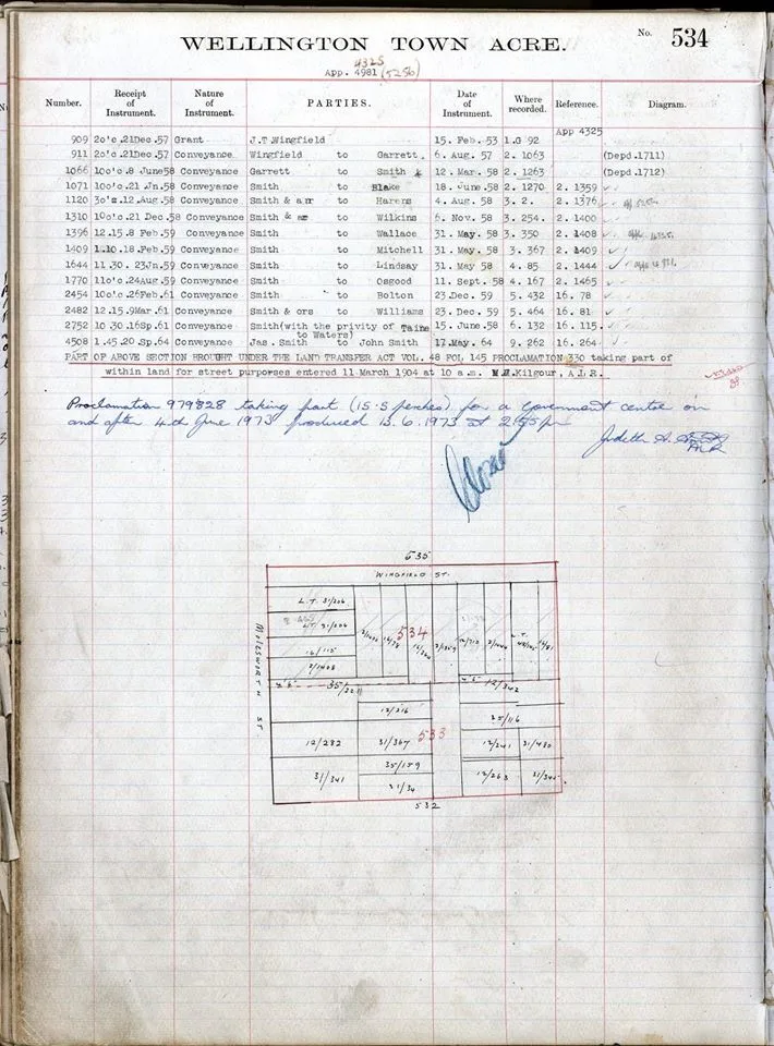
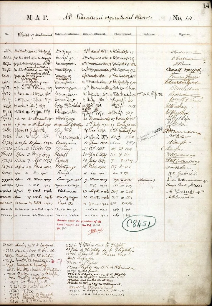
Each page in a Deeds Index documents the transactions registered against a section. The Deeds Index records the time, date, parties and nature of the transaction and refers the researcher to the register in which the transaction was transcribed in full detail.
Knowing the section number is vital to making use of the Deeds Indexes. If you do not know the section number check with our staff – we might be able to help you find the right number.
It’s also worth noting that a ‘section’ can be known by different terms – town acre, parish, rural section or urban section. While the unit remains fundamentally the same, terminology can vary by Land District and whether the section was rural or urban.
An important thing to know is that while a Deeds Index page records everything registered in that section (except for cases where there were so many that multiple pages were needed for a single section) it is not accurate to assume that every transaction documents a change to the entire section.
An owner could subdivide their land, carving multiple properties from their land they hold and sell, lease or mortgage these new properties. Therefore, some of the transactions records on a Deeds Index page may relate to only a small piece of the original section. It is not clear from the typical Deeds Index page which transactions relate to which subdivisions. This can mean that a researcher might have to check several transactions in the Deeds Registers to find the property they are researching as most Deeds Indexes will not include a plan of the section.
It is also important to note that the Deeds Indexes cover only land held in Freehold title. While the land districts nominally covered all of New Zealand the coverage of the indexes only extends for areas settled by Europeans before 1870. Māori land and Crown land are not covered by the Deeds Indexes.
For the North Island in particular this means that much of the interior is not documented in the Deeds System at all.
From 1870 land opened to settlement was administered under the Land Transfer Act – a system entirely separate from the Deeds System and which remains in place today (though substantially amended over nearly 150 years) and the records from this system are held by Land Information New Zealand.
Undertaking land research can be a daunting prospect, but knowing which records apply and can be of use can help the process greatly.
For more information about Deeds Indexes read our Searching land records guide.